


As soon as the spring temperatures finally rise enough for people to step outside without shivering, we are eager to take those first, postwinter steps. Locals need look no further than the East Bay Bike Path to meet that need. Completed 20 years ago (but in the works for 25), it’s the oldest major bike path in Rhode Island. During the past two decades, the trail has consistently been a local hotspot for fitness enthusiasts and families alike; it draws anyone who enjoys spending some quality time outdoors, any season of the year. Best of all, it’s free to use.
The concept for the East Bay Bike Path was originally generated in 1980 by Rhode Island School of Design student Susanne Smith of Barrington. As part of her thesis on landscape architecture, she created a plan to convert the old Providence, Warren and Bristol railroad to what we currently know as the path. As part of this conversion, people would have access to otherwise inaccessible views of the area while cycling or walking. Her hope was that if people saw and appreciated the Narragansett Bay more, they would be less likely to destroy it. After some initial convincing, the Department of Environmental Management responded positively to the idea, and construction of the bike path began in phases, starting in 1987 and reaching completion in 1992.
At 14 and-a-half miles in length, the flat asphalt trail is marked with a dividing line down the middle, which makes it perfect for cycling, running, walking, inline-skating and cross-country skiing. The path starts at India Point Park in Providence (a spot with great views of the Providence River, plenty of room to picnic and a substantial playground for kids of all ages) and ends at Independence Park in Bristol (which boasts waterfront benches and a boardwalk). The trail includes a connection to three miles of paved path at Colt State Park as well. Folks making their way down the path can stop at various destinations in between, and get a feel for five distinctly different communities (Providence, East Providence, Barrington, Warren and Bristol). These areas supply urban waterfront views, stretches of forest, bay views, pastoral areas, small villages, town centers and more.
A rare summer day goes by when one doesn’t encounter a wobbling gang of small helmeted children and their frazzled parents engaging in the time-worn tradition of child-riding-without-training-wheels-for-the-first-time. For these types of events, or for the leisurely stroller who is looking for a half-hour walk, the East Bay Bike Path is broken up into more manageable segments known as phases.
The four phases range in length from 2.38 miles to 4.17 miles. The first phase (also the one that was constructed first), stretches from India Point Park to Riverside Square, and includes a somewhat daunting, narrow trek over the Washington Bridge. The steepest hill of the path also occurs during this leg, though it’s short and a good excuse to earn a well-earned snack after arriving a few miles later in Riverside Square. This section of the path passes parts of the Providence River and assorted marshland (including views of a lighthouse and the historic Squantum Association in East Providence) and ends a hair under four miles later at Riverside Square, an easy spot to park bikes; grab a soft-serve ice cream from a local concession stand in the summer or a coffee from a small local store in colder months.
From Riverside Square the path weaves onward to Barrington County Road, the flattest and newest section of the path. In parts of Barrington (especially where the path flanks Brickyard Pond), people can spot ducklings and chicks during early spring. Just be careful – they tend to frequently take their liberties in ambling slowly across the path as if it were solely their territory. This scenic phase is 4.17 miles in length and passes through Haines Memorial State Park. Feel free to stop and watch the many avid area boaters accessing the boat launch in the park, or use the public restrooms that are available there before ending up at the intersection at Barrington’s County Road.
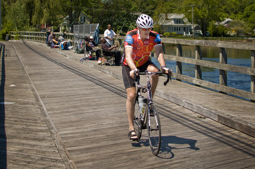
County Road offers a place to stop briefly, for a coffee at Starbucks or lunch at one of the various eateries before continuing forward. There is also shopping and parking here should cyclists wish to start their trek from this destination. Individuals make their way over 2.38 miles of trail during the next leg of the path. This section includes two wooden bridges where folks are often seen whiling away summer days fishing. It then passes through downtown Warren where a Del’s shop awaits with multiple flavors of the icy treat. In Warren, cyclists can often be seen straggling into Your Bike Shop with flat tires or loose chains, only to emerge with bikes that have been restored to “good as new.” This leg of the path ends at Franklin Street in Warren.
The final stretch of the path is 3.87 miles in length and stretches from Franklin Street to Independence Park in Bristol. There can be some brutal head winds in the area, as the East Bay flanks this part of the path. Some people choose to stop at the Audubon Society of Rhode Island’s Education Center, which includes wildlife viewing and a long boardwalk which dissects the path about two miles before its end.
Should anyone prefer to start or stop anywhere along the path beyond these five designated separate legs, access can most easily be gained from India Point Park, Veteran’s Memorial Park, Haines Memorial Park or Colt State Park, as well as 49 intersections in between. Make it a point to enjoy its beauty this summer.


Comments
No comments on this item Please log in to comment by clicking here